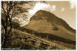
| Kebnekaise |  |
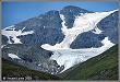
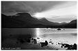
| The Kebnekaise range covers around 500 sq.km, with 200 distinct tops and 50 small (and receding) glaciers. This is the most northerly mountain range in Sweden and Kebnekaise itself is the highest mountain (2117m). Some parts are three to four day's trek from the nearest road, but the area is well provided with huts. The place names of the main geographical features are Lappish and mostly unpronounceable - by me anyway. Try getting your tongue around Kaskasanjunjetjåkkå for instance! |
| |
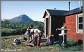
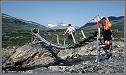
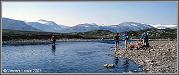
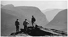
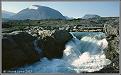
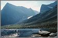
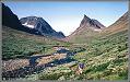
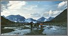
| Lying about 68° north the climate is Arctic with short summers, and snow can lie in the valleys for up to eight months. The terrain is characterized by extensive boulder fields, particularly in the higher valleys where finding somewhere to pitch a tent can be a problem. The lower valleys have their own delights in the form of midges and mosquitoes. Through the area runs the famous Kungsleden, a 440 km long track which starts in Abisko in the north and finishes in the south at Hemavan. Our route started off from Abisko, following the Kungsleden for a while but then deviated east and west to explore the side valleys. The grand finale was to be an ascent of Kebnekaise itself but, alas, the weather gods decreed otherwise. After ten days of glorious sunshine our arrival at the Kebnekaise Fjellstation coincided with a torrential downpour followed by two days of low cloud and rain which put paid to our summit bid. | ||


· Home Page · Site Map · What's New ·